 Up to 8 people
Guides
Language
EnglishCurrency
US dollar · $Prices on GetYourGuide appear in your chosen currency.
Guide · Near Cortina
Cinque Torri hike: the towers, the trenches and the huts
A Cinque Torri hike packs a lot into a short walk: rock towers full of climbers, restored First World War trenches and some of the oldest huts in the Dolomites, a few minutes by chairlift above Cortina.
Check availabilityfrom $150 · free cancellation
Editorial team, dolomiteshikingtour.comUpdated October 25, 20266 minutes to read44 sources
In a nutshell
- 01Easiest version
- The 5 Torri tour from the chairlift: easy, 2 hours, 4.7 km.1
- 02From the valley
- Bai de Dones to Rifugio Cinque Torri: 5.6 km, 302 m up.2
- 03History
- An open-air museum of the Great War among the towers.3
- 04Longer day
- On to Rifugio Nuvolau, the oldest hut in the Dolomites.4
- 05With a guide
- Small groups of up to 8, or a private day.
What the Cinque Torri are, and why people come
The Cinque Torri are a cluster of rock towers on a high meadow west of Cortina, below Nuvolau and Averau. They are first of all a climbers' playground: Cortina's tourism office counts over 200 equipped pitches of every difficulty on them.5 On a clear day you will notice climbers on the walls above you.6
For hikers the draw is a mix you rarely get on one short walk. Between the towers runs a network of restored trenches and gun positions from the First World War, part of an open-air museum which, together with the Lagazuoi and Sass de Stria museums, is the largest in the Dolomites.3 You walk through the front line rather than past a plaque about it.
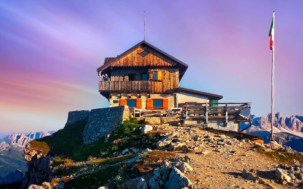
The huts add the third reason. Rifugio Cinque Torri opened in 1904 and is one of the oldest establishments in the area, and Rifugio Scoiattoli sits right by the museum.78 A Cinque Torri hike is rarely about distance; it is about a slow loop with long stops.
The easy loop
The 5 Torri tour in stages
-
Start
Bai de Dones car park
Ride the chairlift up in a few minutes.9
-
Top station
Rifugio Scoiattoli
-
Among the towers
Museum trenches
Follow the signs for the museum route.9
-
East side
Rifugio Cinque Torri
Opened in 1904, an old family-run hut.7
-
Way down
Path 425 to the lake
Through the forest past Lago di Bai de Dones.10
The easy loop from the chairlift
Most people start from the Bai de Dones car park and ride the chairlift up to Rifugio Scoiattoli in a few minutes.9 The chairlift is a four-seater run by Averau Lifts, which operates 4 lifts in the Cinque Torri and Giau area.11 From the top, Cortina's tourism office describes the 5 Torri tour as easy: 2 hours and 4.7 km, starting at 2,255 m, with 67 m of climbing and 446 m of descent back to Bai de Dones.1
The route follows the signs for the museum, past the trenches and through the towers.9 On the east side you can either follow the preserved trenches down the ridge or carry on to Rifugio Cinque Torri, then take path 425 through the forest to the small lake of Bai de Dones and the car park.110
Because almost all of it is downhill, this is the version for mixed groups, older walkers and anyone who wants the history without a climb. It is also the Cinque Torri, Dolomites hiking at its most relaxed: allow far more than 2 hours if you stop in the trenches and at the huts.
With a guide
Small group, private, or the long loop
Up to 8 people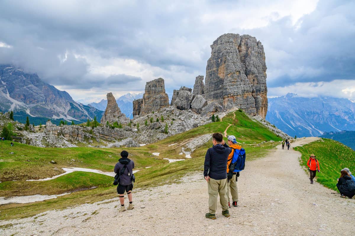 Your party only
 Longest walk
Your version
Which Cinque Torri day fits
Match your energy to the route.
5 Torri tour
2 hours from the chairlift, mostly downhill through the trenches.1
Walk up from Bai de Dones
Rated easy, 302 m of ascent to Rifugio Cinque Torri.2
Passo Giau to Nuvolau
5 hours and 612 m of ascent, rated for experts by Cortina tourism.14
Small-group guided hike
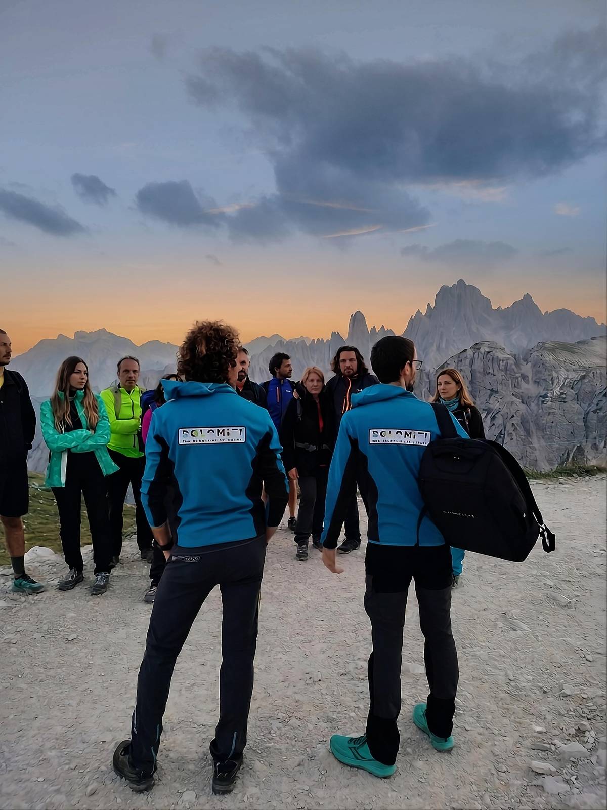
A local guide for up to 8 people, above 2,000 m.
Walking up from Bai de Dones instead
If you prefer to earn the view, walk up. The tourism office's route from Bai de Dones to Rifugio Cinque Torri is rated easy: 2 hours 15 minutes, 5.6 km, with 302 m of ascent, following path 424 into the forest and then path 425.21510 On the way you pass marshes and the edge of the Lago di Bai de Dones, with the Tofane on your left.
From Rifugio Cinque Torri you can retrace your steps, or climb to Rifugio Scoiattoli in about 30 minutes for a different angle on the towers and ride the chairlift back down.16 That combination, up on foot and down by lift, gives you the forest, the meadow and the museum without tired knees at the end.
Check the lift's season before you count on it for the descent. Mountain lifts run on their own calendars, and a closed chairlift turns a short outing into a long walk back to the car park.
Map
The Tre Cime loop, the Cortina hikes and the Alta Via 1
The guided loop around the Tre Cime from Misurina, the Cinque Torri and Lake Sorapis on the Cortina side, then the whole Alta Via 1 from Lago di Braies to Belluno.
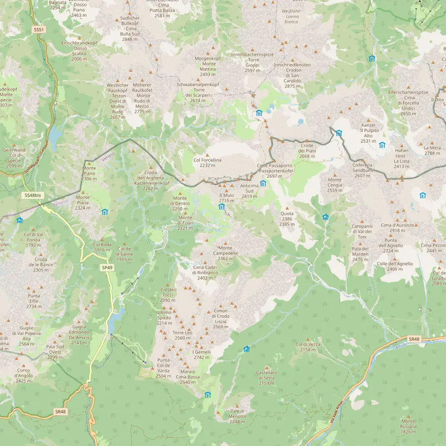 1Misurina2Lago d'Antorno3Rifugio Auronzo4Rifugio Lavaredo5Forcella Lavaredo6Rifugio Locatelli7Malga Langalm8Rifugio Pian di Cengia
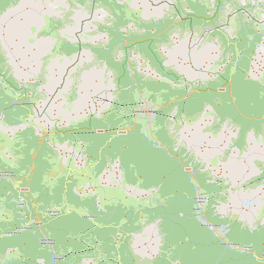 9Cortina d'Ampezzo10Passo Tre Croci11Rifugio Vandelli12Rifugio Scoiattoli13Rifugio Cinque Torri14Rifugio Averau15Rifugio Nuvolau16Passo di Giau17Rifugio Lagazuoi
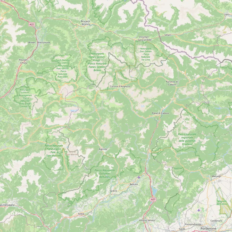 18Lago di Braies19Rifugio Biella20Rifugio Fanes21Rifugio Croda da Lago22Rifugio Coldai23Rifugio Vazzoler24Rifugio Carestiato25Rifugio Pian de Fontana26Rifugio 7° Alpini27Belluno
- 1Misurina
The village at 1,754 m where the guided Tre Cime tour of this site picks you up.17
In Google Maps ↗ - 2Lago d'Antorno
The bookable road to the Tre Cime starts near this small lake; the paid gate is about 3 km from Misurina.1819
In Google Maps ↗ - 3Rifugio Auronzo
Start and finish of the classic loop, at 2,333 m, with the big car park at the end of the road.20
In Google Maps ↗ - 4Rifugio Lavaredo
About 20 minutes on foot from Rifugio Auronzo, at 2,344 m.21
In Google Maps ↗ - 5Forcella Lavaredo
The pass at 2,454 m where the three peaks line up side by side.2022
In Google Maps ↗ - 6Rifugio Locatelli
The hut facing the north walls, the classic photo stop of the loop.22
In Google Maps ↗ - 7Malga Langalm
At 2,285 m, the last stop before the loop closes at Rifugio Auronzo.23
In Google Maps ↗ - 8Rifugio Pian di Cengia
A quieter hut at 2,528 m, reached on more demanding trails.24
In Google Maps ↗ - 9Cortina d'Ampezzo
The town the Cinque Torri and Sorapis hikes start from; about 30 minutes by car to Misurina.25
In Google Maps ↗ - 10Passo Tre Croci
Trailhead of path 215 to Lake Sorapis.26
In Google Maps ↗ - 11Rifugio Vandelli
The hut beside Lake Sorapis, at 1,926 m.27
In Google Maps ↗ - 12Rifugio Scoiattoli
At 2,255 m by the top of the Cinque Torri chairlift, where the 5 Torri tour starts.1
In Google Maps ↗ - 13Rifugio Cinque Torri
Opened in 1904, at the foot of the towers.7
In Google Maps ↗ - 14Rifugio Averau
At Forcella Averau, 2,413 m.12
In Google Maps ↗ - 15Rifugio Nuvolau
Built in 1883 at 2,575 m, the oldest hut in the Dolomites.4
In Google Maps ↗ - 16Passo di Giau
Start of the hike up to Rifugio Nuvolau.14
In Google Maps ↗ - 17Rifugio Lagazuoi
At 2,752 m by the cable car from Passo Falzarego.13
In Google Maps ↗ - 18Lago di Braies
Start of stage 1 of the Alta Via 1.28
In Google Maps ↗ - 19Rifugio Biella
At 2,327 m, end of stage 1, usually open mid-June to mid-September.2930
In Google Maps ↗ - 20Rifugio Fanes
End of stage 2 and start of the climb to Lagazuoi.3132
In Google Maps ↗ - 21Rifugio Croda da Lago
End of stage 5 from Rifugio Nuvolau.33
In Google Maps ↗ - 22Rifugio Coldai
On stage 7 from Palafavera towards Rifugio Vazzoler.34
In Google Maps ↗ - 23Rifugio Vazzoler
End of stage 7.34
In Google Maps ↗ - 24Rifugio Carestiato
End of stage 8.35
In Google Maps ↗ - 25Rifugio Pian de Fontana
End of stage 10.36
In Google Maps ↗ - 26Rifugio 7° Alpini
Start of the last stage down to Belluno.37
In Google Maps ↗ - 27Belluno
Where the Alta Via 1 ends, at 389 m.38
In Google Maps ↗
Before you go
Plan the Cinque Torri day
01
Bring
- Shoes with grip for trench steps
- A warm layer for the top station
- Cash for the huts
- Water and a snack
02
Check
- Chairlift season and last run
- Hut opening before you rely on lunch
- Forecast for afternoon storms
- Lift ticket at Bai de Dones
Video
Discovering the Cinque Torri
No data goes to YouTube until you press play on this clip.
A longer day: Passo Giau, Averau and Nuvolau
For a full mountain day, start at Passo Giau instead. Cortina's tourism office describes the hike to Rifugio Nuvolau as one for experts: 5 hours, 9.8 km, 612 m of ascent.14 Path 443 climbs from the pass, then path 439 leads to Rifugio Scoiattoli and on past Rifugio Averau to the summit hut.3940
Rifugio Nuvolau, built in 1883 at 2,575 m on the summit of Monte Nuvolau, is the oldest mountain hut in the Dolomites, and its terrace looks over the Cinque Torri below.4 Rifugio Averau, at 2,413 m on Forcella Averau, has 7 rooms and 41 beds if you want to stay up for sunset.12
There is a guided version of this circuit as well. A loop from Passo Giau goes via Forcella Averau and Rifugio Nuvolau to the Cinque Torri and back, about 10 km with 700 m of ascent and about 6 hours of walking. It starts from $116 and has no reviews yet.
Guided Cinque Torri hikes, and what they cost
The small-group option is a guided panoramic hike with a local guide, for up to 8 people, starting in front of Ristorante Da Strobel. The route stays above 2,000 m, covers 7 to 10 km with 400 to 600 m of ascent, and takes in First World War remains, the south face of Tofana di Rozes and a view to the Marmolada. It starts from $231 and has 2 reviews, both 5.0.
The private option is built around the classic stops. It meets at the Bai de Dones car park by the chairlift, rides up, spends 80 minutes among the towers and 40 minutes at Rifugio Scoiattoli, with the trenches and gun posts of the museum on the way. Its guide leads in English for 5 hours; prices begin at $1,808, and no reviews exist yet.
That price buys a guide for your party alone, which makes sense for families or friends who want to set the pace and ask questions all day. A couple on a budget will get more from the small-group hike, or from walking the easy loop alone and adding a guided day elsewhere.
Small things that make the day easier
The Cinque Torri are easy to underestimate because the walking is short. The top station sits at 2,255 m, and even on a warm day in the valley the wind across the meadow can be cold, so carry a layer you can pull on in the trenches.1 Cortina's tourism office also advises leaving early, when the weather tends to be more stable, which here also means finding a place at the car park.41
Bring cash for the huts. The same office warns that credit cards may not work at mountain huts, especially in bad weather, when the connection drops.42 Lunch at Rifugio Cinque Torri or Rifugio Scoiattoli is part of the experience, and an empty wallet turns it into a picnic on the grass.
Inside the trenches, watch your footing: steps are uneven, some passages are narrow and dark, and children need a hand. Treat the walls and wooden structures as a museum, because that is what they are, and keep to the marked route among the towers where climbers may drop rocks from above.
Nearby: Lagazuoi and the Alta Via 1
The Cinque Torri sit on a much bigger stage. Just west, the cable car from Passo Falzarego lifts you in a few minutes to Rifugio Lagazuoi, at 2,752 m the highest hut on Cortina's side, which is also a base for the open-air museum of the Great War.1343
A guided Lagazuoi hike starts from the top of that cable car and walks 5 to 9 km almost all downhill, in groups of up to 8, from $265. The Alta Via 1 also passes here: its stage from Rifugio Lagazuoi to Rifugio Nuvolau runs 15 km in about 5 hours 30 minutes.44
So a Cinque Torri day can be the gentle introduction to a bigger plan, from a Lagazuoi morning to a few days hut to hut. The hut-to-hut page of this site explains how those stages fit together.
Your Tre Cime day
Walk round the Tre Cime with a local guide.
Meet in Misurina, ride up the booked road and cancel free until 24 hours before.


You ask,we answer.
How long is the Cinque Torri hike?
About 2 hours for the easy loop. The 5 Torri tour from Rifugio Scoiattoli is 4.7 km and mostly downhill.1
Can I take a chairlift to the Cinque Torri?
Yes, from Bai de Dones. The chairlift from the Bai de Dones car park reaches Rifugio Scoiattoli in a few minutes.9
What is the open-air museum at the Cinque Torri?
Restored Great War trenches. With the Lagazuoi and Sass de Stria museums it is the largest in the Dolomites.3
Is the walk up from Bai de Dones hard?
No, it is rated easy. It is 5.6 km with 302 m of ascent, about 2 hours 15 minutes.2
Is there a guided Cinque Torri hike?
Yes, small-group and private. The small-group guided hike takes up to 8 people above 2,000 m, from $231.
Which is the oldest hut nearby?
Rifugio Nuvolau, from 1883. Rifugio Nuvolau was built in 1883 and stands at 2,575 m above the Cinque Torri.4
Sources
Evidence for this guide
- 1Cortina d'Ampezzo tourism (Cortina Marketing)5 Torri tour↩
- 2Cortina d'Ampezzo tourism (Cortina Marketing)To Rifugio Cinque Torri↩
- 3Cortina d'Ampezzo tourism (Cortina Marketing)Open-air museum of the Great War (at Cinque Torri)↩
- 4Cortina d'Ampezzo tourism (Cortina Marketing)Rifugio Nuvolau↩
- 5Cortina d'Ampezzo tourism (Cortina Marketing)To Rifugio Cinque Torri↩
- 6Cortina d'Ampezzo tourism (Cortina Marketing)5 Torri tour↩
- 7Cortina d'Ampezzo tourism (Cortina Marketing)To Rifugio Cinque Torri↩
- 8Cortina d'Ampezzo tourism (Cortina Marketing)Rifugio Scoiattoli↩
- 9Cortina d'Ampezzo tourism (Cortina Marketing)5 Torri tour↩
- 10Cortina d'Ampezzo tourism (Cortina Marketing)To Rifugio Cinque Torri↩
- 11Cortina d'Ampezzo tourism (Cortina Marketing)Averau - Cinque Torri lifts↩
- 12Cortina d'Ampezzo tourism (Cortina Marketing)Rifugio Averau↩
- 13Cortina d'Ampezzo tourism (Cortina Marketing)Ascent to the summit of Piccolo Lagazuoi↩
- 14Cortina d'Ampezzo tourism (Cortina Marketing)To Rifugio Nuvolau↩
- 15Cortina d'Ampezzo tourism (Cortina Marketing)To Rifugio Cinque Torri↩
- 16Cortina d'Ampezzo tourism (Cortina Marketing)To Rifugio Cinque Torri↩
- 17Municipality of Auronzo di Cadore (auronzo.info)Misurina, the Pearl of the Dolomites↩
- 18Municipality of Auronzo di Cadore (auronzo.info)How to get to the Tre Cime di Lavaredo↩
- 19Municipality of Auronzo di Cadore (auronzo.info)Parking Tre Cime di Lavaredo↩
- 20Municipality of Auronzo di Cadore (auronzo.info)The Tre Cime di Lavaredo, One of The Natural Wonders of Italy↩
- 21Municipality of Auronzo di Cadore (auronzo.info)The Tre Cime di Lavaredo, One of The Natural Wonders of Italy↩
- 22Municipality of Auronzo di Cadore (auronzo.info)The Tre Cime di Lavaredo, One of The Natural Wonders of Italy↩
- 23Municipality of Auronzo di Cadore (auronzo.info)The Tre Cime di Lavaredo, One of The Natural Wonders of Italy↩
- 24Municipality of Auronzo di Cadore (auronzo.info)The Tre Cime di Lavaredo, One of The Natural Wonders of Italy↩
- 25Municipality of Auronzo di Cadore (auronzo.info)Misurina, the Pearl of the Dolomites↩
- 26Cortina d'Ampezzo tourism (Cortina Marketing)To Lago Sorapis↩
- 27Cortina d'Ampezzo tourism (Cortina Marketing)Rifugio Vandelli↩
- 28Cortina d'Ampezzo tourism (Cortina Marketing)Alta Via N.1↩
- 29Cortina d'Ampezzo tourism (Cortina Marketing)Alta Via N.1 - Stage 1↩
- 30Cortina d'Ampezzo tourism (Cortina Marketing)Alta Via N.1 - Stage 1↩
- 31Cortina d'Ampezzo tourism (Cortina Marketing)Alta Via N.1↩
- 32Cortina d'Ampezzo tourism (Cortina Marketing)Alta Via N.1↩
- 33Cortina d'Ampezzo tourism (Cortina Marketing)Alta Via N.1↩
- 34Cortina d'Ampezzo tourism (Cortina Marketing)Alta Via N.1↩
- 35Cortina d'Ampezzo tourism (Cortina Marketing)Alta Via N.1↩
- 36Cortina d'Ampezzo tourism (Cortina Marketing)Alta Via N.1↩
- 37Cortina d'Ampezzo tourism (Cortina Marketing)Alta Via N.1↩
- 38Cortina d'Ampezzo tourism (Cortina Marketing)Alta Via N.1 - Stage 12↩
- 39Cortina d'Ampezzo tourism (Cortina Marketing)To Rifugio Nuvolau↩
- 40Cortina d'Ampezzo tourism (Cortina Marketing)To Rifugio Nuvolau↩
- 41Cortina d'Ampezzo tourism (Cortina Marketing)Tips for experiencing the mountains↩
- 42Cortina d'Ampezzo tourism (Cortina Marketing)Tips for experiencing the mountains↩
- 43Cortina d'Ampezzo tourism (Cortina Marketing)Rifugio Lagazuoi↩
- 44Cortina d'Ampezzo tourism (Cortina Marketing)Alta Via N.1↩
Keep reading