 Summit at 3,046 m
Mount Popera, 2 days
Night at Rifugio Carducci
- Group
- Up to 7
- Level
- Challenging
- Price
- from $300
Guides
Language
EnglishCurrency
US dollar · $Prices on GetYourGuide appear in your chosen currency.
Guide · Several days
Walking from one mountain hut to the next is the purest way to see these mountains. Here is how the classic route is built, when the huts open, and what a guided version looks like today.
Editorial team, dolomiteshikingtour.comUpdated October 25, 20266 minutes to read50 sources
The essentials
A rifugio is a staffed mountain hut with beds, usually in dormitories, and a kitchen that serves dinner and breakfast to the people who sleep there. Strung together, they let you walk for days across the high Dolomites with only a day pack's worth of extra kit: no tent, no stove, no food for a week.
That is the appeal of hut to hut hiking in the Dolomites. Each day ends at a door, a hot meal and a bunk, and each morning starts above the valleys. Huts close for the winter and some only open for a short summer season, so the walking calendar is set by them, not by you.35
The Municipality of Auronzo describes Rifugio Carducci, at the foot of Croda dei Toni, as a key reference point for multi-day traverses, and that is how most people use the huts: as stepping stones rather than destinations.6 Book them in advance in high season, and contact each hut before setting off to check it is open.45
A first hut night
Months ahead
Huts on the loop take guests; book ahead in summer.4
Week before
Confirm it is open and serving food.5
Morning
The road to Rifugio Auronzo needs a booking.7
Afternoon
The classic loop is about 10 km with about 400 m of height difference.8
Evening
The pink light is called Enrosadira.9
The best-known route is the Alta Via 1 in the Dolomites, which Cortina's tourism office divides into 12 stages, from Lago di Braies in the north to Belluno in the south.12 Each stage is graded for experts, with walking times of 3 to 6 hours a day.102
Stage 1 starts with an easy shore path along Lago di Braies, then climbs 900 m to Rifugio Biella, at 2,327 m below the Croda del Becco.11 Stage 3 is the big one, climbing 1,070 m from Rifugio Fanes to Rifugio Lagazuoi.12 Stage 4 runs 15 km from Lagazuoi to Rifugio Nuvolau and passes the Castelletto, a rock fortress of the 1915-18 war under Tofana di Rozes.1314
The southern half crosses wilder country past Rifugio Coldai, Tissi and Vazzoler, then Carestiato, Pramperet and Pian de Fontana.15161710 The last stage from Rifugio 7° Alpini drops about 1,900 m to Belluno, at 389 m.218 Knees, not lungs, decide that final day.
Alta Via 1
| Stage | From and to | Time | Length |
|---|---|---|---|
| 1 | Lago di Braies to Rifugio Biella | 4 h 30 | 6 km |
| 2 | Rifugio Biella to Rifugio Fanes | 4 h 30 | 14 km |
| 3 | Rifugio Fanes to Rifugio Lagazuoi | 5 h | 11 km |
| 4 | Rifugio Lagazuoi to Rifugio Nuvolau | 5 h 30 | 15 km |
| 5 | Nuvolau to Croda da Lago | 4 h 30 | 11 km |
| 6 | Croda da Lago to Palafavera | 5 h 30 | 12 km |
| 7 | Palafavera to Rifugio Vazzoler | 6 h | 14 km |
| 8 | Vazzoler to Carestiato | 4 h | 8 km |
| 9 | Carestiato to Pramperet | 5 h | 13 km |
| 10 | Pramperet to Pian de Fontana | 3 h | 6 km |
Stages 11 and 12, Pian de Fontana to Rifugio 7° Alpini and on to Belluno, take 4 and 6 hours.1192013212215161710232
Bookable or your own
Summit at 3,046 mNight at Rifugio Carducci
 Off the beaten path
Night at a mountain lodge
 The classic
Pick a format
Start from your days and experience.
Built in 1906 and rebuilt in 1926, it serves as a small hotel and is typically open from mid-June to mid-September.
Hut seasons are short and they shape every plan. Rifugio Biella, built in 1906 and rebuilt in 1926, works as a small hotel and is typically open from mid-June to mid-September.3 Rifugio Lagazuoi, at 2,752 m, is the highest hut on the Cortina side and doubles as a base for the open-air museum of the Great War.2526
Rifugio Nuvolau, built in 1883 at 2,575 m, is the oldest mountain hut in the Dolomites, a small summit house with a huge view.27 Close by, Rifugio Averau has 7 rooms and 41 beds, and Rifugio Scoiattoli 6 rooms and 42 beds, useful when Nuvolau is full.2829
Closing dates move every year. Near the Tre Cime in 2026, Rifugio Carducci and Rifugio Locatelli closed on 27 September, Rifugio Lavaredo on 11 October.3031 The Municipality of Auronzo asks walkers to contact each hut before setting off to confirm it is open and serving food.5
Map
The guided loop around the Tre Cime from Misurina, the Cinque Torri and Lake Sorapis on the Cortina side, then the whole Alta Via 1 from Lago di Braies to Belluno.
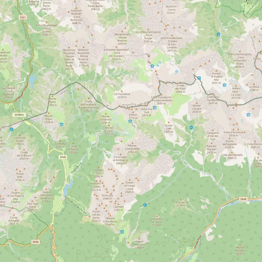 1Misurina2Lago d'Antorno3Rifugio Auronzo4Rifugio Lavaredo5Forcella Lavaredo6Rifugio Locatelli7Malga Langalm8Rifugio Pian di Cengia
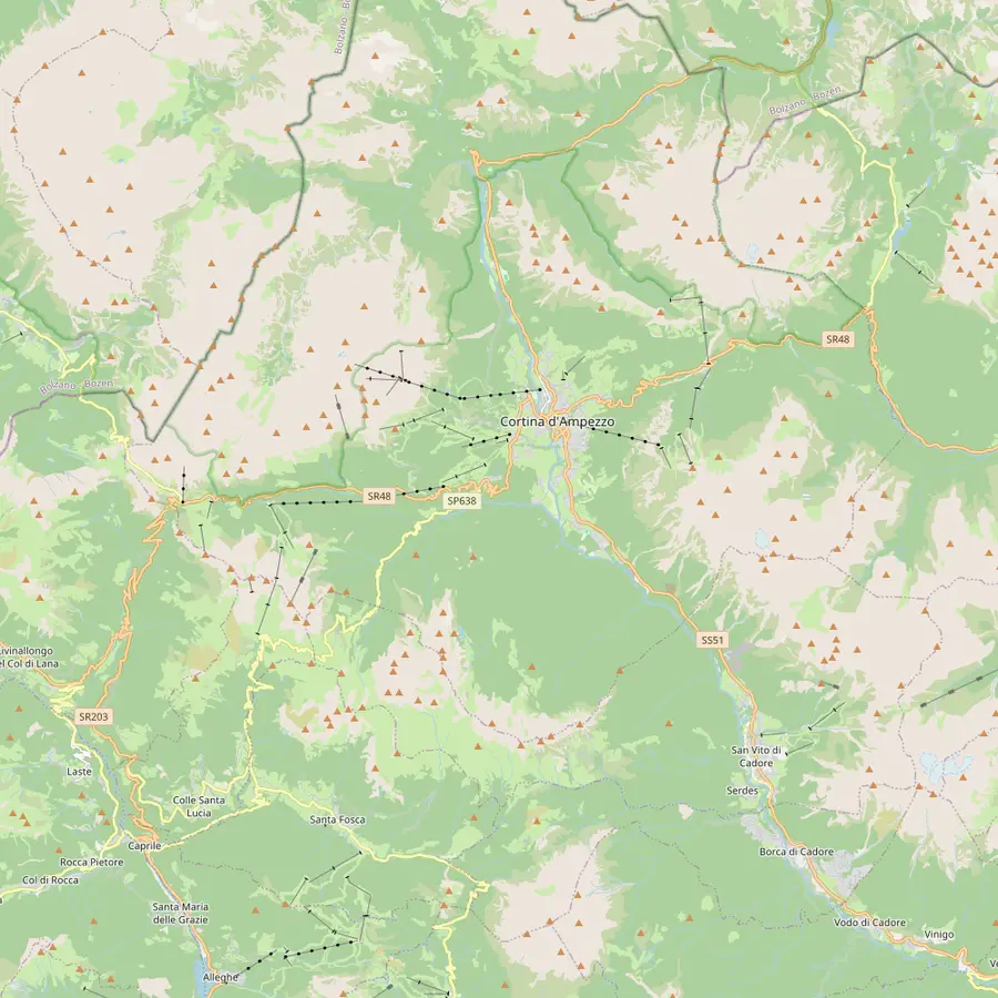 9Cortina d'Ampezzo10Passo Tre Croci11Rifugio Vandelli12Rifugio Scoiattoli13Rifugio Cinque Torri14Rifugio Averau15Rifugio Nuvolau16Passo di Giau17Rifugio Lagazuoi
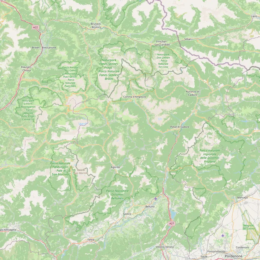 18Lago di Braies19Rifugio Biella20Rifugio Fanes21Rifugio Croda da Lago22Rifugio Coldai23Rifugio Vazzoler24Rifugio Carestiato25Rifugio Pian de Fontana26Rifugio 7° Alpini27Belluno
The village at 1,754 m where the guided Tre Cime tour of this site picks you up.32
In Google Maps ↗The bookable road to the Tre Cime starts near this small lake; the paid gate is about 3 km from Misurina.3334
In Google Maps ↗Start and finish of the classic loop, at 2,333 m, with the big car park at the end of the road.35
In Google Maps ↗About 20 minutes on foot from Rifugio Auronzo, at 2,344 m.36
In Google Maps ↗The pass at 2,454 m where the three peaks line up side by side.3537
In Google Maps ↗The hut facing the north walls, the classic photo stop of the loop.37
In Google Maps ↗At 2,285 m, the last stop before the loop closes at Rifugio Auronzo.38
In Google Maps ↗A quieter hut at 2,528 m, reached on more demanding trails.39
In Google Maps ↗The town the Cinque Torri and Sorapis hikes start from; about 30 minutes by car to Misurina.40
In Google Maps ↗Trailhead of path 215 to Lake Sorapis.41
In Google Maps ↗The hut beside Lake Sorapis, at 1,926 m.42
In Google Maps ↗At 2,255 m by the top of the Cinque Torri chairlift, where the 5 Torri tour starts.43
In Google Maps ↗Opened in 1904, at the foot of the towers.44
In Google Maps ↗At Forcella Averau, 2,413 m.28
In Google Maps ↗Built in 1883 at 2,575 m, the oldest hut in the Dolomites.27
In Google Maps ↗Start of the hike up to Rifugio Nuvolau.45
In Google Maps ↗At 2,752 m by the cable car from Passo Falzarego.25
In Google Maps ↗Start of stage 1 of the Alta Via 1.1
In Google Maps ↗At 2,327 m, end of stage 1, usually open mid-June to mid-September.113
In Google Maps ↗End of stage 2 and start of the climb to Lagazuoi.1920
In Google Maps ↗End of stage 5 from Rifugio Nuvolau.21
In Google Maps ↗On stage 7 from Palafavera towards Rifugio Vazzoler.15
In Google Maps ↗End of stage 7.15
In Google Maps ↗End of stage 8.16
In Google Maps ↗End of stage 10.10
In Google Maps ↗Start of the last stage down to Belluno.2
In Google Maps ↗Where the Alta Via 1 ends, at 389 m.18
In Google Maps ↗Hut kit
Video
No data goes to YouTube until you press play on this clip.
Not on GetYourGuide, and it is better to say so plainly than to sell you something close. Among the listings we found near Cortina and the Tre Cime, no tour walks the Alta Via 1 from end to end.1 The Cortina mountain guides do offer multi-day hiking and trekking among their activities, so that is where to ask for a guided version.24
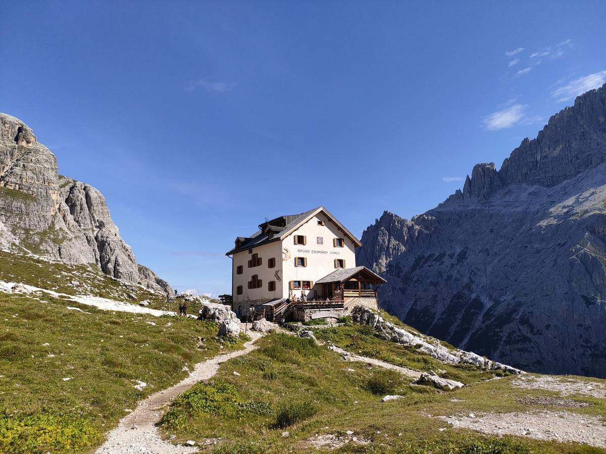
What you can book are short hut treks. A 2-day trek climbs Mount Popera, 3,046 m, from Sesto: day 1 walks up Val Fiscalina past Rifugio Comici and Forcella Giralba to Rifugio Carducci, with dinner and breakfast at the hut included, and day 2 reaches the summit over short passages of easy rock. It follows a stretch of the Alta Via no. 5, is listed as challenging, and takes up to 7 hikers.
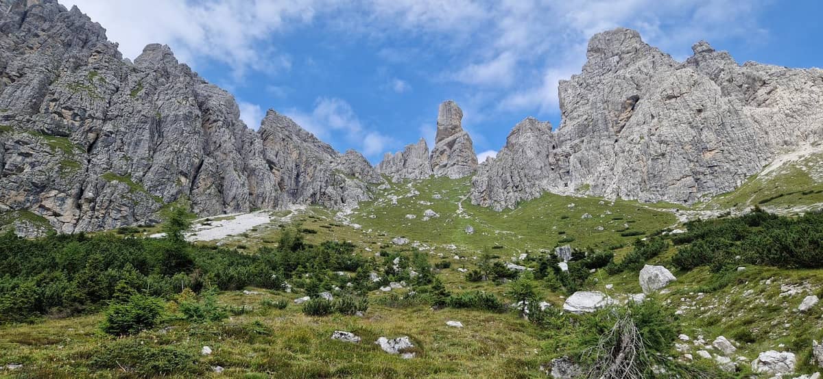
A second 2-day trek crosses the wild Marmarole with a night at a mountain lodge, over Forcella Bajon and down Val Bajon, also for up to 7. They start from $300 and $254, and neither has reviews yet, so you would be among the first.
The grade for experts on every Alta Via 1 stage is not about climbing skill; it is about stamina, mountain sense and sure feet day after day.1 The numbers explain why. Stage 1 alone climbs 900 m from the lake to Rifugio Biella, and stage 3 gains 1,070 m to Lagazuoi, before the long 15 km of stage 4.111213
A good test at home is a long, hilly day walk with a loaded day pack, repeated the very next morning on tired legs. If the second day feels fine, the hut rhythm will too. If it does not, choose a shorter section or plan rest days at huts with a view worth sitting still for.
Altitude adds to the effort. Lagazuoi sits at 2,752 m, and most of the route stays well above the valleys, where breath comes shorter and the sun burns faster.25 Walk slowly at the start of each stage, drink more than you think, and turn back early on any day when a storm builds.
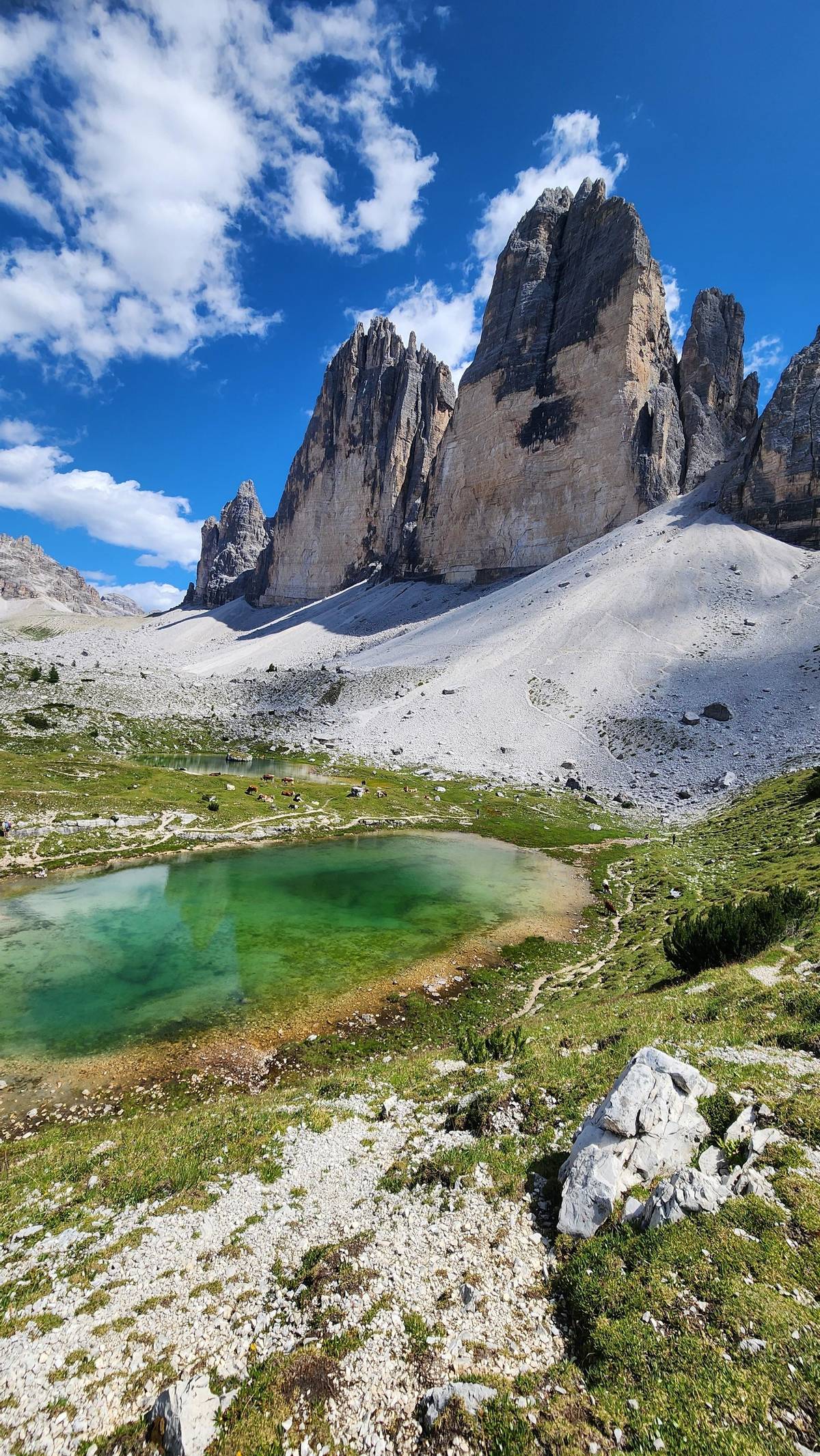
You do not need a week to sleep in a hut. Around the Tre Cime, Rifugio Auronzo, Rifugio Lavaredo, Rifugio Locatelli and Rifugio Pian di Cengia all take overnight guests, so the famous loop can become an overnight trip with dawn on the north walls.4 Pian di Cengia, at 2,528 m, is also the base for the Giro dei Tre Rifugi, a longer circuit for stronger walkers.39
North of Cortina, Cortina's tourism office describes a Ring of the three mountain huts through the Natural Park of the Ampezzo Dolomites, past Rifugio Biella at 2,327 m.46 The park covers 11,200 hectares, and the ring shows its meadows, plateaus and small lakes in one day.47
Those short trips are the best test before a longer trek. One night teaches you how dormitories feel, how early huts wake up, and how your legs cope with a second day at altitude.
Pick your section first, then book the beds, then everything else. The Municipality of Auronzo advises booking huts in advance in high season, so fix the nights at the smallest huts first and build the trip around them.4 Keep a spare day for weather; a storm day spent in a hut is far better than a ridge in lightning.
Carry cash. Cortina's tourism office warns that credit cards may not work at huts, especially in bad weather.48 Start each stage early, when weather tends to be more stable, and know that the emergency number in the mountains is 118.4950
Pack light, because you carry it all day for days: a sleeping-bag liner, a headlamp, layers for cold evenings, rain gear, a small first-aid kit and the map. Shoes matter more than anything else; break them in at home, not on stage 1.
Your Tre Cime day
Meet in Misurina, ride up the booked road and cancel free until 24 hours before.
12, in Cortina tourism's version. From Lago di Braies to Belluno, each stage graded for experts.12
Lago di Braies to Belluno. Stage 1 starts at Lago di Braies; stage 12 ends in Belluno, at 389 m.118
Mostly in summer. Rifugio Biella, for example, usually opens from mid-June to mid-September.3
Not end to end. The closest listings are 2-day hut treks, such as Mount Popera with a night at Rifugio Carducci.
Do not count on it. Cortina tourism advises carrying cash, as cards may not work, especially in bad weather.48
Stage 3 climbs the most. Stage 3 gains 1,070 m on the way from Rifugio Fanes up to Rifugio Lagazuoi.12
Yes, several huts take guests. Rifugio Auronzo, Lavaredo, Locatelli and Pian di Cengia offer beds; book ahead.4
Sources
Keep reading