 4 reviews, 5.0
Guides
Language
EnglishCurrency
US dollar · $Prices on GetYourGuide appear in your chosen currency.
Guide · Lake hike
Lago di Sorapis hike: what the trail asks of you
The milky turquoise lake under the Sorapis rewards a hike that is longer and more exposed than photos suggest. Here is the classic path, its tricky section, and the guided loop that avoids doubling back.
Check availabilityfrom $150 · free cancellation
Editorial team, dolomiteshikingtour.comUpdated October 25, 20266 minutes to read41 sources
At a glance
- 04The colour
- Fine rock dust from the melting Sorapis glacier.5
- 05Guided
- A loop of about 12 km from Federavecchia, 4 reviews.
Why this lake looks the way it does
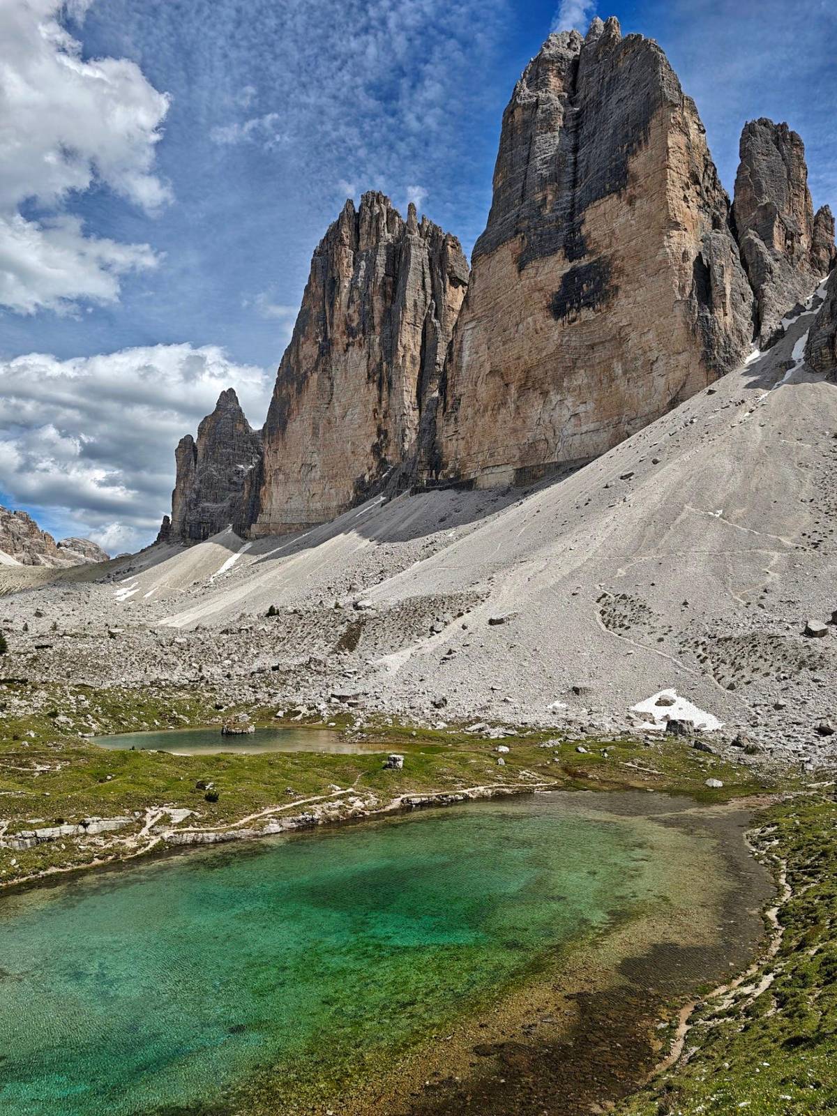
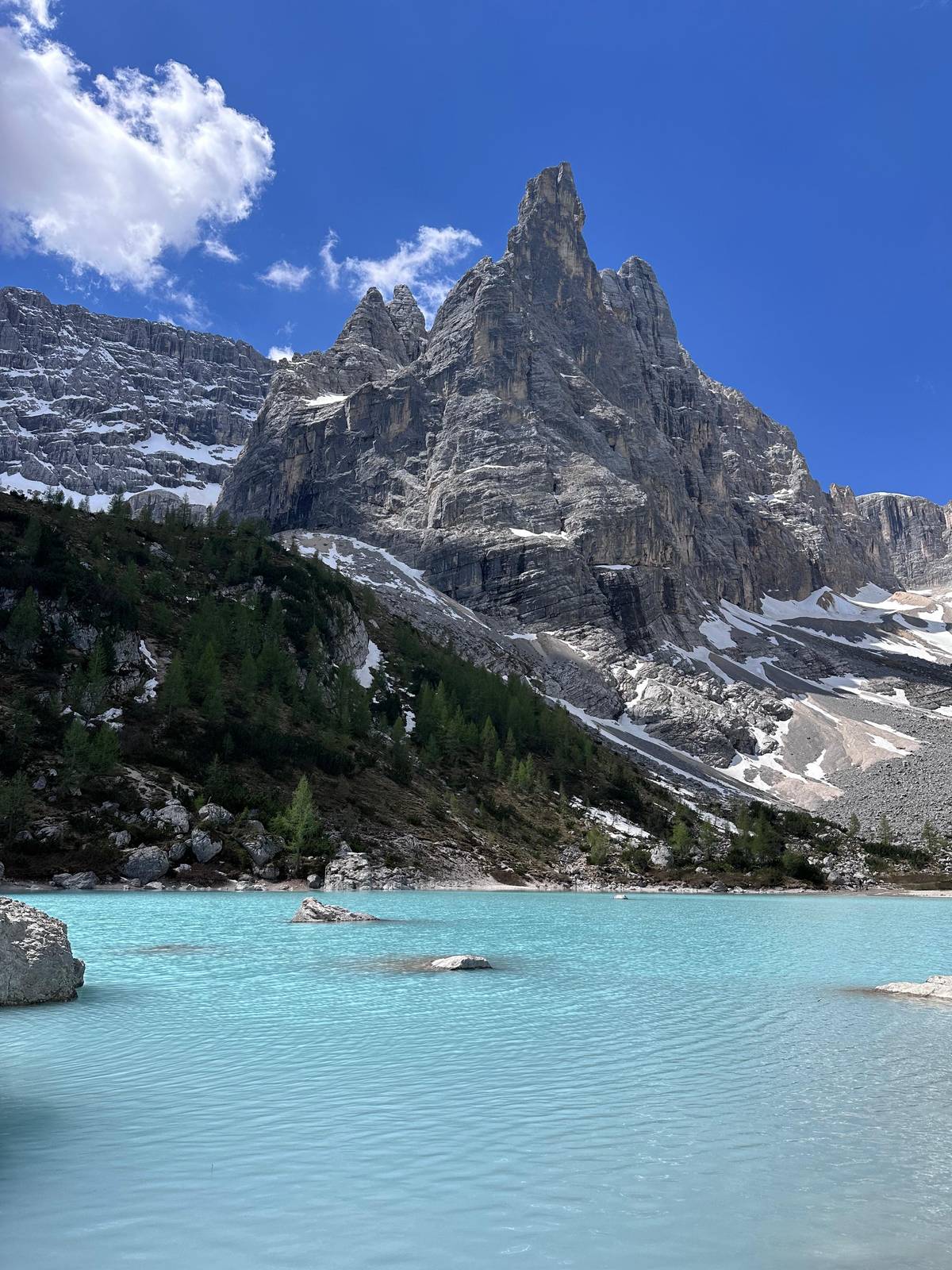
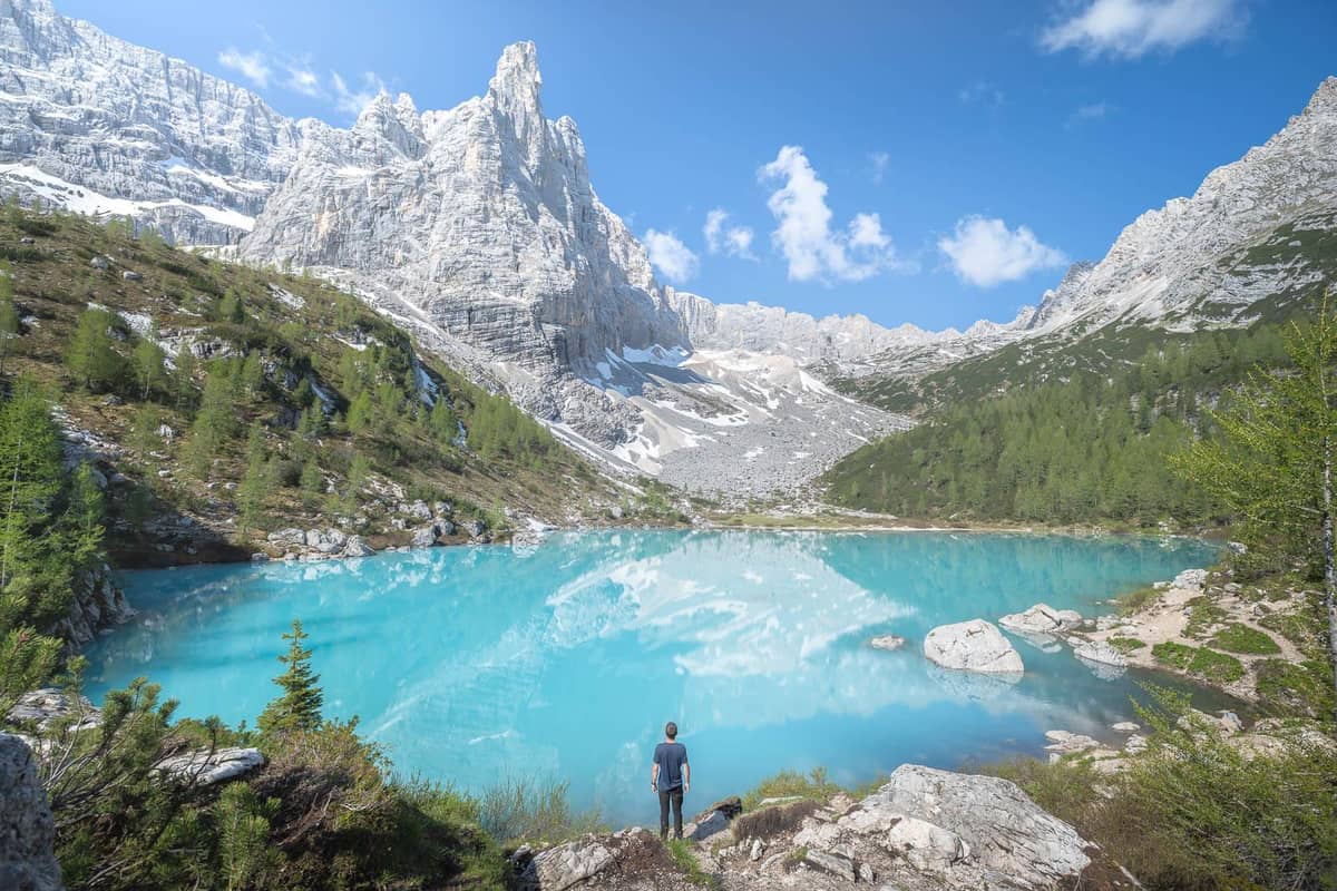
The colour is the whole story of this hike, and it has a simple cause. Cortina's tourism office explains that the blue to aqua-green comes from very fine rock dust carried by the Sorapis glacier as it melts in spring and summer.5 The dust stays suspended in the water and scatters the light, which is why the lake looks almost opaque.
The lake also behaves oddly. It is carved into the rock and has no surface outlet; its water leaves underground and reappears below the rock step as the el Piss waterfall, which gives the whole mountain group its local name, Sora el Piss.6 Above it rises the slender Dito di Dio, at 2,603 m.7
That combination of glacier, cliff and colour makes this one of the most photographed spots in the Dolomites, and the Municipality of Auronzo calls the hike fairly demanding but highly rewarding.8 It is worth knowing what that demanding part is before you set out.
The classic path
The classic route in stages
-
Start
Passo Tre Croci
The most used trailhead, between Cortina and Misurina.8
-
First part
Forest path
Ups and downs with a slight overall height difference.1
-
Middle
Ladders and ledges
Short equipped sections with wire ropes.2
-
Arrival
Rifugio Vandelli
At 1,926 m, a few minutes from the lake.3
-
Return
Back on path 215
Cortina tourism advises the same route back.9
The classic route on path 215
The usual start is Passo Tre Croci, on the road between Cortina and Misurina; the whole drive from Cortina to Misurina over the pass takes about 30 minutes.810 Cortina's tourism office gives the out-and-back on path 215 as 4 hours and 10.5 km, rising to 1,926 m with 434 m of ascent, and rates it for experts.12
The first part is a pleasant forest path with ups and downs and views back to the Cristallo, the Cadini di Misurina and the Tre Cime. Then comes a more challenging section with metal ladders and exposed passages along a flat ledge, equipped with wire ropes.2 After these short equipped bits you soon reach Rifugio Vandelli and the lake behind a low rise.
For the return the office advises taking the same route, back along path 215.9 That means crossing the ledges twice, which is the main reason this walk feels harder than its height gain suggests.
Options compared
Ways to reach Lake Sorapis
| Option | Start | Distance & climb | Time | From |
|---|---|---|---|---|
| On your own | Passo Tre Croci | 10.5 km, 434 m | 4 hours | Free |
| Guided loop | Federavecchia | About 12 km, 700 m | 6 hours | $125 |
| Private from Venice | Venice | 10 km round trip | 11 hours | $2,302 |
| Trail run | See listing | Lake & Rifugio Vandelli | 6 hours | $162 |
Self-guided figures from Cortina d'Ampezzo tourism; the rest as each GetYourGuide listing states them.1
With a guide
Guided ways to the lake
4 reviews, 5.0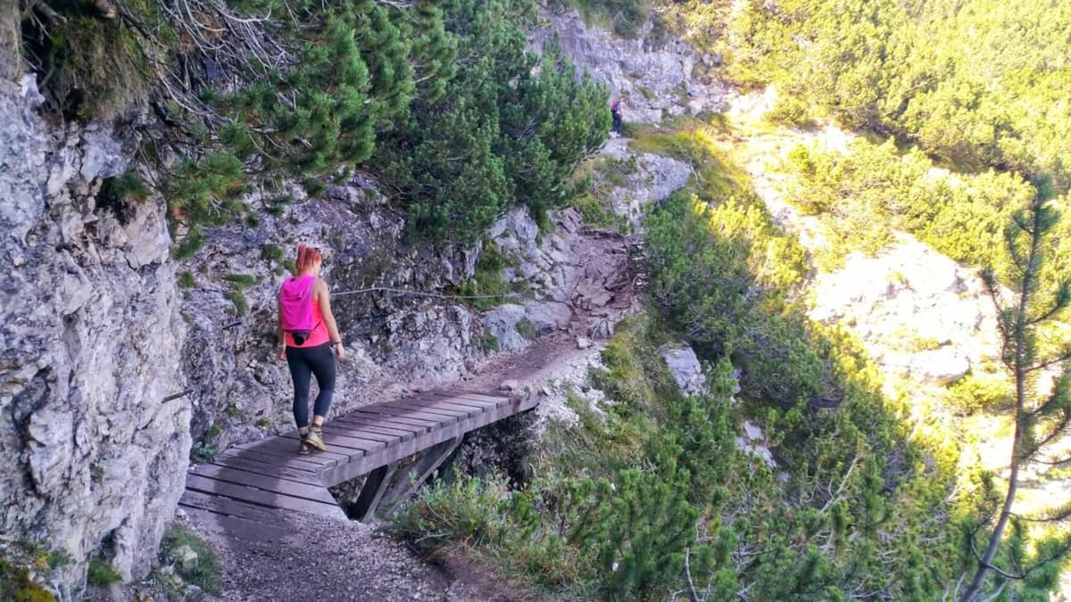 Whole day
Private from Venice
Alpine guide, van
- Length
- 11 hours
- Walk
- 10 km round trip
- Price
- from $2,302
 Up to 10
Your call
Alone, guided or not at all?
Be honest about ledges and time.
Guided loop
A guide walks you through the few slightly exposed sections.
Private day from Venice
The van takes you to Passo Tre Croci and back, 11 hours in all.
This colouration derives from the very fine rock dust carried by the glacier of the same name, which, as it melts during spring and summer, gives life to the lake.
How exposed are the ledges, honestly
Nothing on path 215 needs climbing skills, but parts of it run along a ledge with a drop on one side and a steel cable to hold on the other, and in places you step up short metal ladders.2 For most hikers that is a few minutes of concentration. For anyone with real vertigo it can be a wall.
If you are unsure, walk the forest section first and decide at the start of the equipped stretch; turning back there costs you the lake but nothing else. Keep children close and on the inside, and do not overtake on the cable sections. Wet rock after rain makes them slippery, so pick a dry day if you have a choice.
This is where a guide earns their fee on this hike. The guided listing describes only a few slightly exposed sections on its return and says you can come back the same way instead if heights bother you. Having someone beside you who has walked it many times changes how those metres feel.
Map
The Tre Cime loop, the Cortina hikes and the Alta Via 1
The guided loop around the Tre Cime from Misurina, the Cinque Torri and Lake Sorapis on the Cortina side, then the whole Alta Via 1 from Lago di Braies to Belluno.
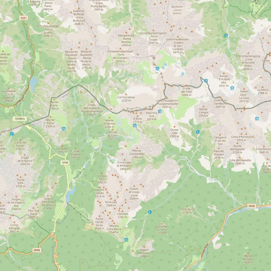 1Misurina2Lago d'Antorno3Rifugio Auronzo4Rifugio Lavaredo5Forcella Lavaredo6Rifugio Locatelli7Malga Langalm8Rifugio Pian di Cengia
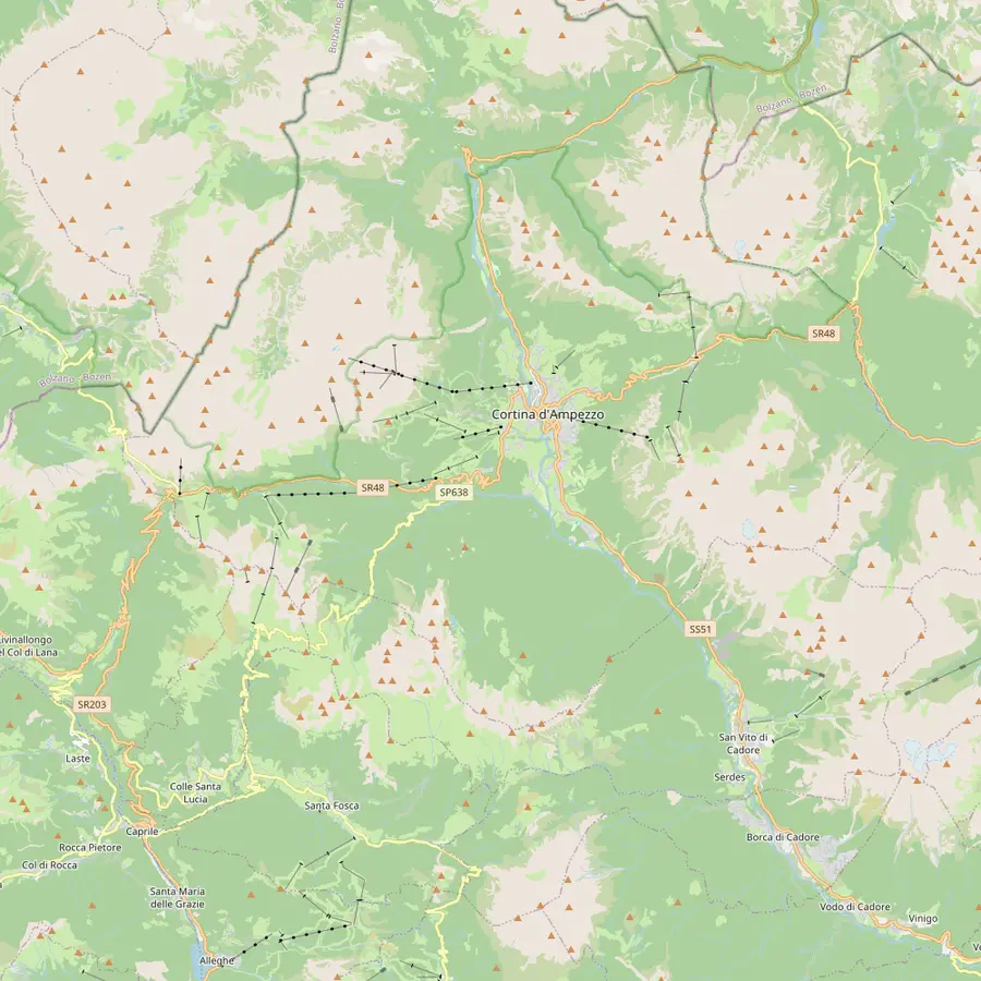 9Cortina d'Ampezzo10Passo Tre Croci11Rifugio Vandelli12Rifugio Scoiattoli13Rifugio Cinque Torri14Rifugio Averau15Rifugio Nuvolau16Passo di Giau17Rifugio Lagazuoi
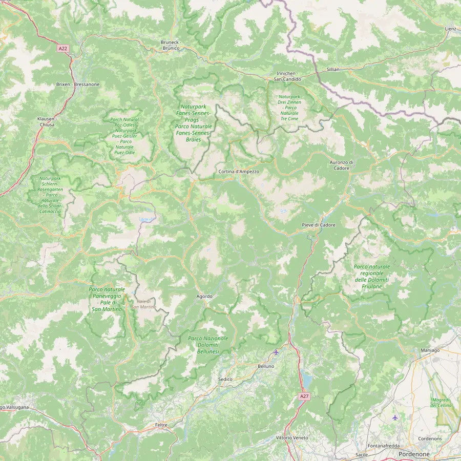 18Lago di Braies19Rifugio Biella20Rifugio Fanes21Rifugio Croda da Lago22Rifugio Coldai23Rifugio Vazzoler24Rifugio Carestiato25Rifugio Pian de Fontana26Rifugio 7° Alpini27Belluno
- 1Misurina
The village at 1,754 m where the guided Tre Cime tour of this site picks you up.12
In Google Maps ↗ - 2Lago d'Antorno
The bookable road to the Tre Cime starts near this small lake; the paid gate is about 3 km from Misurina.1314
In Google Maps ↗ - 3Rifugio Auronzo
Start and finish of the classic loop, at 2,333 m, with the big car park at the end of the road.15
In Google Maps ↗ - 4Rifugio Lavaredo
About 20 minutes on foot from Rifugio Auronzo, at 2,344 m.16
In Google Maps ↗ - 5Forcella Lavaredo
The pass at 2,454 m where the three peaks line up side by side.1517
In Google Maps ↗ - 6Rifugio Locatelli
The hut facing the north walls, the classic photo stop of the loop.17
In Google Maps ↗ - 7Malga Langalm
At 2,285 m, the last stop before the loop closes at Rifugio Auronzo.18
In Google Maps ↗ - 8Rifugio Pian di Cengia
A quieter hut at 2,528 m, reached on more demanding trails.19
In Google Maps ↗ - 9Cortina d'Ampezzo
The town the Cinque Torri and Sorapis hikes start from; about 30 minutes by car to Misurina.10
In Google Maps ↗ - 10Passo Tre Croci
Trailhead of path 215 to Lake Sorapis.2
In Google Maps ↗ - 11Rifugio Vandelli
The hut beside Lake Sorapis, at 1,926 m.3
In Google Maps ↗ - 12Rifugio Scoiattoli
At 2,255 m by the top of the Cinque Torri chairlift, where the 5 Torri tour starts.20
In Google Maps ↗ - 13Rifugio Cinque Torri
Opened in 1904, at the foot of the towers.21
In Google Maps ↗ - 14Rifugio Averau
At Forcella Averau, 2,413 m.22
In Google Maps ↗ - 15Rifugio Nuvolau
Built in 1883 at 2,575 m, the oldest hut in the Dolomites.23
In Google Maps ↗ - 16Passo di Giau
Start of the hike up to Rifugio Nuvolau.24
In Google Maps ↗ - 17Rifugio Lagazuoi
At 2,752 m by the cable car from Passo Falzarego.25
In Google Maps ↗ - 18Lago di Braies
Start of stage 1 of the Alta Via 1.26
In Google Maps ↗ - 19Rifugio Biella
At 2,327 m, end of stage 1, usually open mid-June to mid-September.2728
In Google Maps ↗ - 20Rifugio Fanes
End of stage 2 and start of the climb to Lagazuoi.2930
In Google Maps ↗ - 21Rifugio Croda da Lago
End of stage 5 from Rifugio Nuvolau.31
In Google Maps ↗ - 22Rifugio Coldai
On stage 7 from Palafavera towards Rifugio Vazzoler.32
In Google Maps ↗ - 23Rifugio Vazzoler
End of stage 7.32
In Google Maps ↗ - 24Rifugio Carestiato
End of stage 8.33
In Google Maps ↗ - 25Rifugio Pian de Fontana
End of stage 10.34
In Google Maps ↗ - 26Rifugio 7° Alpini
Start of the last stage down to Belluno.35
In Google Maps ↗ - 27Belluno
Where the Alta Via 1 ends, at 389 m.36
In Google Maps ↗
Pack and plan
For the Sorapis day
01
Bring
- Boots with firm grip for wet rock
- Water, the trail has no shop
- Cash for Rifugio Vandelli
- A warm, waterproof layer
02
Plan
- An early start from Passo Tre Croci
- A dry forecast for the ledges
- Hut open dates before you go
- A turn-back point if heights bother you
Video
How to get to Lago di Sorapis: a complete guide
No data goes to YouTube until you press play on this clip.
The guided loop from Federavecchia
The reviewed guided option takes a different line. It starts from Federavecchia, meets in front of the closed Hotel Cristallo, and walks a loop of about 12 km with about 700 m of ascent through forest and open viewpoints up to Rifugio Vandelli and the lake. Its return includes a few slightly exposed sections, with the option of returning the way you came.
It lasts 6 hours, is guided in Italian, English, French and Spanish, and starts from $125. It has 4 reviews, all 5.0, and a bad-weather cancellation brings a new date or a full refund.
Other guided formats exist too. A private day from Venice with an alpine guide does the classic path from Passo Tre Croci, 10 km round trip, as an 11-hour day, from $2,302. And a trail-running tour for small groups of up to 10 reaches the lake and Rifugio Vandelli and returns towards Rifugio Faloria.
Rifugio Vandelli and a night at the lake
Rifugio Vandelli stands at 1,926 m in the middle of the northern cirque of the Sorapis, almost on the edge of the rock step where the waterfall drops; the lake is a few minutes away over a short rise.3 The hut was originally built in 1890.4
It is small: 1 room with 4 beds and 5 dormitories with 32 beds.37 Sleeping there turns a day hike into an evening and an early morning by the water, with the light on the Dito di Dio and the cirque to yourself for a while.
Like every hut it runs on its own season, and its kitchen is the only food on the trail, so bring water and a snack anyway. Cortina's tourism office suggests carrying cash, because cards may not work at mountain huts, especially in bad weather.38
If the ledges are not for you: other water walks near Cortina
Lake Sorapis is not the only way to spend a day by water in the Ampezzo valley. The Gores de Federa is a newer path created by the Regole d'Ampezzo through the Federa forest, past waterfalls and small gorges and over several suspension bridges.39 Cortina's tourism office rates it medium: 3 hours 10 minutes, 6.8 km, with 466 m of ascent, ending at Malga Federa with views of the Becco di Mezzodi.39
There is a guided version with pick-up in Cortina, 8 km round trip with 400 m of ascent, open to families with children aged 10 and over, from $173. Bring cash for the hut, since the listing says cards are not always accepted.
Closer to the Tre Cime, Misurina's own lake lies at 1,754 m and has a flat path around it, and the small Lago d'Antorno sits just above it on the road to Rifugio Auronzo.1214 Neither has the Sorapis colour, but both give you water and peaks without a single ladder.
When to go and how to plan the day
Treat this as a summer and early autumn hike. The private listing from Venice gives the path as open from June through October, and in the shoulder months snow can linger on the shaded sections. Check conditions before you go and contact the hut to confirm it is open.40
Start early. Cortina's tourism office recommends leaving in the morning, when weather tends to be more stable and you avoid returning after sunset.41 An early start also gives you the lake in softer light, with time to sit by the shore without watching the clock.
If you combine this hike with the Tre Cime, keep them on separate days. Both are full outings, and both are better with fresh legs; the Tre Cime page of this site explains the booked road and the guided loop there. A sensible split is the Tre Cime loop on the first fine day, when the booked road and the long views matter most, and Lake Sorapis on the next, starting at Passo Tre Croci early enough to cross the equipped ledges before the trail gets busy in both directions.
Your Tre Cime day
Walk round the Tre Cime with a local guide.
Meet in Misurina, ride up the booked road and cancel free until 24 hours before.


You ask,we answer.
How long is the hike to Lake Sorapis?
About 4 hours there and back. Cortina tourism gives 10.5 km and 434 m of ascent from Passo Tre Croci on path 215.12
Is the Lake Sorapis hike difficult?
It is rated for experts. There are metal ladders and exposed ledges with wire ropes after a flat start.21
Where does the hike start?
Usually at Passo Tre Croci. The Municipality of Auronzo names Passo Tre Croci as the most commonly used access point.8
Why is Lake Sorapis so blue?
Glacier dust in the water. Fine rock dust from the melting Sorapis glacier gives the colour.5
Is there a guided Lake Sorapis hike?
Yes, a loop of about 12 km. It starts from Federavecchia and reaches Rifugio Vandelli, from $125.
Can I sleep at the lake?
Yes, at Rifugio Vandelli. Rifugio Vandelli has 1 room with 4 beds and 5 dormitories with 32 beds in all.37
Should I return a different way?
Cortina advises the same route. The office recommends going back along path 215, as you came.9
Sources
Evidence for this guide
- 1Cortina d'Ampezzo tourism (Cortina Marketing)To Lago Sorapis↩
- 2Cortina d'Ampezzo tourism (Cortina Marketing)To Lago Sorapis↩
- 3Cortina d'Ampezzo tourism (Cortina Marketing)Rifugio Vandelli↩
- 4Cortina d'Ampezzo tourism (Cortina Marketing)To Lago Sorapis↩
- 5Cortina d'Ampezzo tourism (Cortina Marketing)To Lago Sorapis↩
- 6Cortina d'Ampezzo tourism (Cortina Marketing)To Lago Sorapis↩
- 7Cortina d'Ampezzo tourism (Cortina Marketing)To Lago Sorapis↩
- 8Municipality of Auronzo di Cadore (auronzo.info)Summer Hiking in Auronzo di Cadore↩
- 9Cortina d'Ampezzo tourism (Cortina Marketing)To Lago Sorapis↩
- 10Municipality of Auronzo di Cadore (auronzo.info)Misurina, the Pearl of the Dolomites↩
- 11Municipality of Auronzo di Cadore (auronzo.info)The Tre Cime di Lavaredo, One of The Natural Wonders of Italy↩
- 12Municipality of Auronzo di Cadore (auronzo.info)Misurina, the Pearl of the Dolomites↩
- 13Municipality of Auronzo di Cadore (auronzo.info)How to get to the Tre Cime di Lavaredo↩
- 14Municipality of Auronzo di Cadore (auronzo.info)Parking Tre Cime di Lavaredo↩
- 15Municipality of Auronzo di Cadore (auronzo.info)The Tre Cime di Lavaredo, One of The Natural Wonders of Italy↩
- 16Municipality of Auronzo di Cadore (auronzo.info)The Tre Cime di Lavaredo, One of The Natural Wonders of Italy↩
- 17Municipality of Auronzo di Cadore (auronzo.info)The Tre Cime di Lavaredo, One of The Natural Wonders of Italy↩
- 18Municipality of Auronzo di Cadore (auronzo.info)The Tre Cime di Lavaredo, One of The Natural Wonders of Italy↩
- 19Municipality of Auronzo di Cadore (auronzo.info)The Tre Cime di Lavaredo, One of The Natural Wonders of Italy↩
- 20Cortina d'Ampezzo tourism (Cortina Marketing)5 Torri tour↩
- 21Cortina d'Ampezzo tourism (Cortina Marketing)To Rifugio Cinque Torri↩
- 22Cortina d'Ampezzo tourism (Cortina Marketing)Rifugio Averau↩
- 23Cortina d'Ampezzo tourism (Cortina Marketing)Rifugio Nuvolau↩
- 24Cortina d'Ampezzo tourism (Cortina Marketing)To Rifugio Nuvolau↩
- 25Cortina d'Ampezzo tourism (Cortina Marketing)Ascent to the summit of Piccolo Lagazuoi↩
- 26Cortina d'Ampezzo tourism (Cortina Marketing)Alta Via N.1↩
- 27Cortina d'Ampezzo tourism (Cortina Marketing)Alta Via N.1 - Stage 1↩
- 28Cortina d'Ampezzo tourism (Cortina Marketing)Alta Via N.1 - Stage 1↩
- 29Cortina d'Ampezzo tourism (Cortina Marketing)Alta Via N.1↩
- 30Cortina d'Ampezzo tourism (Cortina Marketing)Alta Via N.1↩
- 31Cortina d'Ampezzo tourism (Cortina Marketing)Alta Via N.1↩
- 32Cortina d'Ampezzo tourism (Cortina Marketing)Alta Via N.1↩
- 33Cortina d'Ampezzo tourism (Cortina Marketing)Alta Via N.1↩
- 34Cortina d'Ampezzo tourism (Cortina Marketing)Alta Via N.1↩
- 35Cortina d'Ampezzo tourism (Cortina Marketing)Alta Via N.1↩
- 36Cortina d'Ampezzo tourism (Cortina Marketing)Alta Via N.1 - Stage 12↩
- 37Cortina d'Ampezzo tourism (Cortina Marketing)Rifugio Vandelli↩
- 38Cortina d'Ampezzo tourism (Cortina Marketing)Tips for experiencing the mountains↩
- 39Cortina d'Ampezzo tourism (Cortina Marketing)Gores de Federa↩
- 40Municipality of Auronzo di Cadore (auronzo.info)Mountain hut closures in Auronzo, Misurina and the Tre Cime: 2026 dates↩
- 41Cortina d'Ampezzo tourism (Cortina Marketing)Tips for experiencing the mountains↩
Keep reading